Dukhizhizniki in America
An update of Molokans in America (Berokoff, 1969).
Enhanced and edited by Andrei Conovaloff, 2012. Send comments to Administrator@Molokane.org
Maps [Contents]
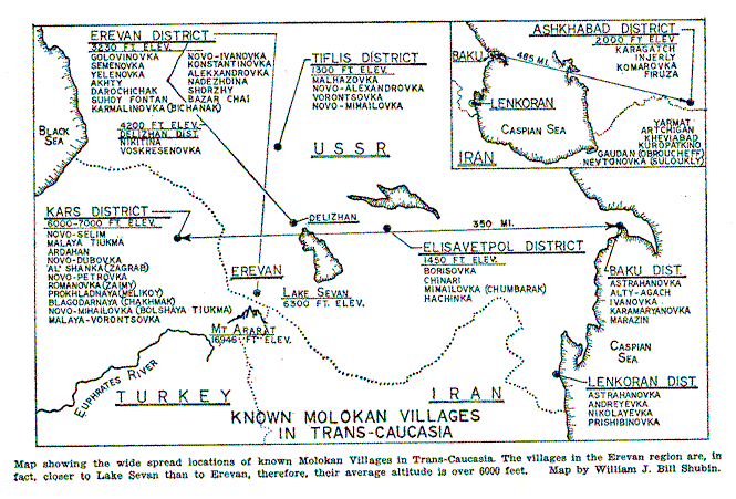
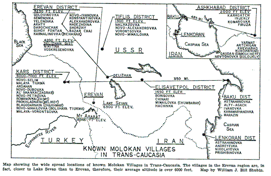
"Known Molokan Villages in Trans-Caucasia" by W.J. Shubin, from Berokoff, Molokans in America. Rough black & white drawing, not to scale. 2 scanned sizes:
- Screen-size - entire map appears in 800x600 pixel browser window.
Not easy to read when printed. (file name: villages.gif -- size: 53K)- Larger than screen size - entire map appears in 1024x760 pixel browser window.
Easy to read. Prints ledgible in landscape (sideways). (file name: map2.gif -- size: 98K)
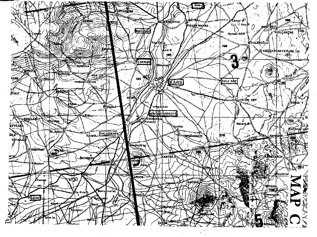
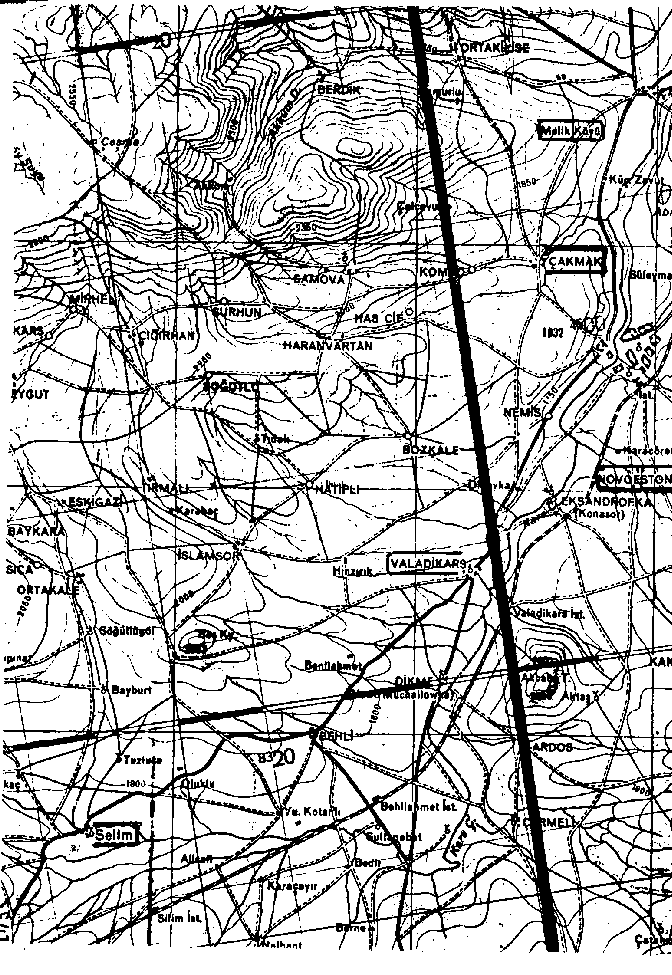
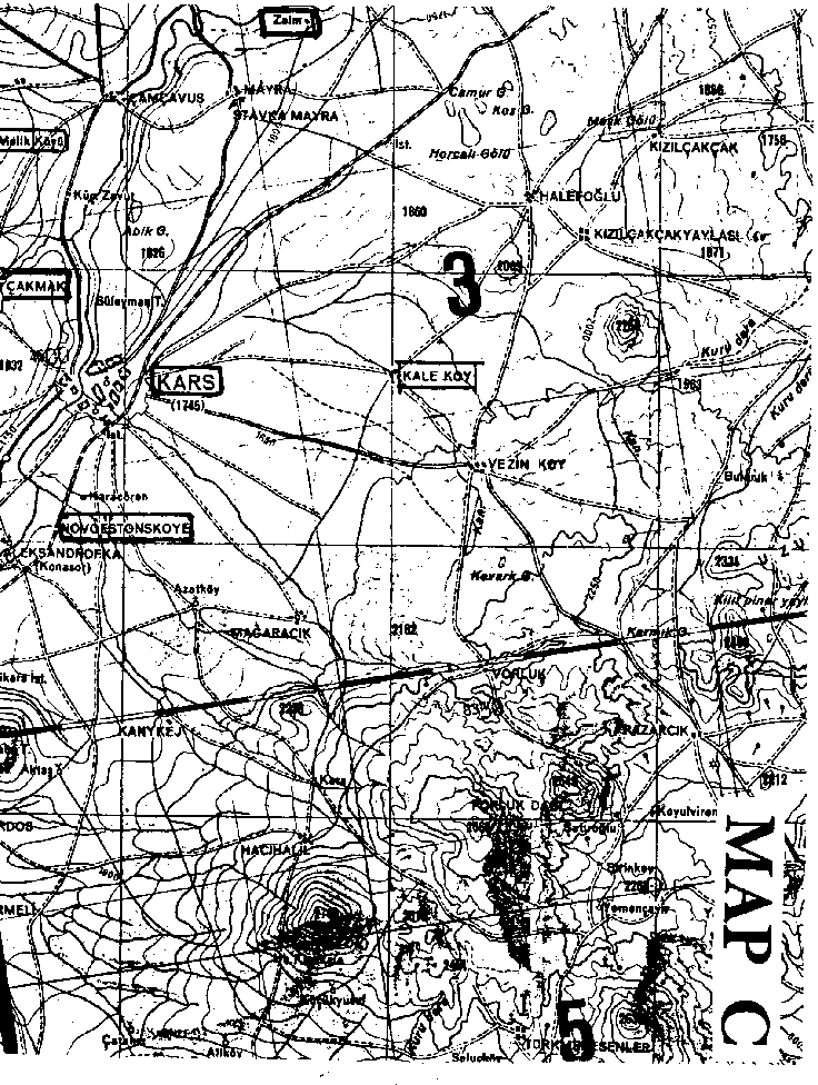
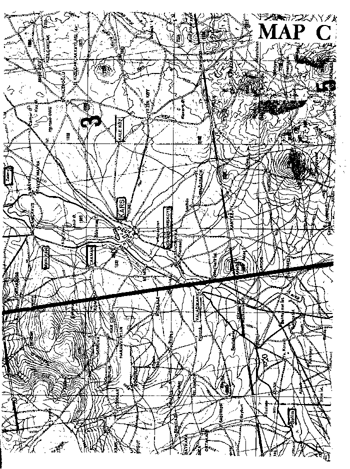
Kars area: (from The 1980 Molokan Directory)
- Large - readable in browser, but too big to print. Print in 2 parts and splice: Part A, Part B
- Small - sideways in browser, but prints on one page.
New maps: Spiritual Christian settlements in Kars oblast, Old Russia (Russian Empire)
from Doukhobor Genealogy Website, by Jonathan Kalmakoff.
- Doukhobor Settlements in the Republic of Turkey [drawn with non-Doukhobor Spiritual Christians marked as "Molokan"]
- Kars Doukhobor and Molokan Villages, 1879-1921 [Google map locations marked "Molokan" are non-Doukhobor Spiritual Christians]
[Contents]
Spiritual Christian History
Spiritual Christians Around the World